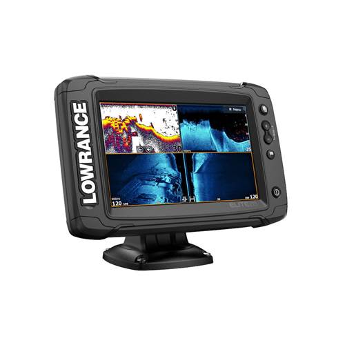
Lowrance Elite-7 TI2 Combo With Active Imaging 3 in 1 Transducer

SOLD OUT
Original Price $1,399.00
Current Price $1,179.90

✖ Out of Stock

Found it Cheaper? We'll beat it!

    Free shipping to most of Australia on orders over $89

    Description

    Featuring support for Active Imaging™, FishReveal™ and built-in coastal US, Australia, New Zealand or worldwide basemap and Genesis Live onscreen mapping, the Elite-7 Ti² fishfinder/chartplotter is big enough for use as standalone display , but has a small enough footprint to be a perfect fit for boats with limited console space.

    Detailed Description

    • Active Imaging™ 3-in-1 (CHIRP/SideScan/DownScan) ready*
    • C-MAP® Genesis Live
    • Smartphone Notifications
    • Wireless Networking
    • FishReveal™ Smart Target View
    • C-MAP® Easy Routing, Navionics® Autorouting capability**
    • Preloaded coastal US, Australia, New Zealand or worldwide basemap, plus a multitude of mapping options, including C-MAP, Navionics® and more
    • Easy-to-use, high-resolution SolarMAX™ touchscreen display
    • Built-in CHIRP and Broadband Sounder®
    • Touchscreen control of Power-Pole® anchors, MotorGuide® Xi5 Trolling Motor
    • Integrated wireless connectivity
    • SonicHub®2 compatible
    • NMEA 2000® engine support
    • Enhanced Surface Clarity lets you see more fish targets near the surface
    • Quick Access Control Bar provides one–touch access to system controls

    Specifications

    • Power Consumption max: 0.9A @ 13VDC with backlight on full
    • Power Consumption typical: 0.9A @ 13VDC with backlight on full
    • Power Consumption min: 0.9A @ 13VDC with backlight on full
    • SD Card Storage: 1 micro SD card up to 32GB
    • Ethernet Ports: 1 virtual ethernet port
    • Update rate: 10 Hz
    • GPS: 10 Hz Internal high-sensitivity WAAS + EGNOS + MSAS
    • Shock Vibration: 100,000 cycles of 20 G
    • Compass Safe: 12" (300mm)
    • Screen Brightness: 1200 nits
    • Supply Voltage: 12v DC (10.8-17VDC)
    • GPS Receiver Channels: 16
    • NMEA 2000 Connectivity: 1x Micro-C
    • Warranty Period: 2 years + 3 additional years of upgrade options. Totaling 5 years
    • Weight: 2.20 lbs (1.00 kg)
    • Position Accuracy: 20m RMS
    • Waypoints, Routes, Tracks: 3000 Waypoints100 Routes100 Trails with up to 10,000 points per trail
    • Time to First Fix: 30s
    • Recommended Fuse Rating: 3A
    • Storage Temperature Range: 4°F to 140°F (-20°C to 60°C )
    • Operating Temperature Range: 5°F to 131°F (-15°C to 55°C )
    • Humidity: 60°C, 95% relative humidity (RH) for 18 hours
    • Viewing Angles: 80° top/bottom, 85° left/right
    • Display Resolution: 800x480
    • AIS: AIS Chart overlay. Target vessel details.
    • Charts supported: C-MAP (MAX N, MAX N+)C-MAP GenesisC-MAP Precision Contour HD (AMER ONLY)Navionics (Gold, NAV+ Platinum+)Insight (Pro and HD)Lowrance Regional Mapping Partners
    • Cartography included: C-MAP AUS/NZ Basemap (AUS/NZ models)Navionics basemap (AMER, AUS/NZ and US Costal/ROW models)
    • Correction: DGPS, WAAS
    • Mounting Type: Gimbal Bracket or Dash Flush Mount
    • Bluetooth: Integrated
    • Sonar Compatibility: Integrated: CHIRPBroadbandActive Imaging DownScanActive Imaging SideScanCompatible with:StructureScan
    • Item Connectivity WiFi: Internal 802.11b/g/n
    • Waterproof rating: IPX7 with card door closed

    Customer Reviews

    Be the first to write a review
    0%
    (0)
    0%
    (0)
    0%
    (0)
    0%
    (0)
    0%
    (0)